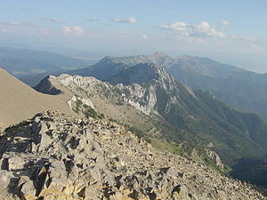
 This week we are talking about map reading and terrain analysis! By Coach Nick It’s Wilderness medicine Wednesday again! This week I am going to be writing about map reading. I know that this does not seem directly related to medicine, but I think this is useful for a lot of reasons. Today will specifically be about contour lines which help us look at a map and understand the terrain that we will be dealing with. Knowing how to understand this can be useful in trip planning, and emergency situations. Primarily, in emergency situations we can look at terrain and make a route for evacuation that avoids dangerous areas and will help us get out of trouble faster. You may be thinking, what are contour lines and where do I find them? Well, they look like this and around found on pretty much any topographical map. 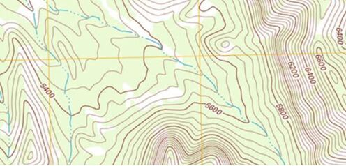 An important thing to look at when it comes to contour lines is the contour interval. This tells you how much elevation change each line represents. The way to find this out is by using two known points, counting how many lines are in between and then dividing the difference. For example, in the picture above we can go to the line that shows 5600ft and count 5 lines between that and 5800 ft. We know that the difference between the 2 points is a total of 200ft, when we divide that by 5 we can see that each line represents a 40ft change in elevation. It’s important to know this scale and what units we are working with because not all maps are the same and it can be very misleading. Now that we know this information let’s talk about what it means to use. When lines are closer together, for example on the East side of the picture above it means that the elevation is changing very fast compared to when they are further apart. By using the elevation we can tell which direction that is going. So, if the were walking East on this map we would be going up in elevation, therefore heading uphill on a very steep grade. Obviously if we were walking West we would be going downhill very quickly. This is important to understand especially if we are carrying a patient or experiencing weather like snow or ice. Let’s talk about recognizing important terrain features just by looking at contour lines. Of course, recognizing mountain summits, fingers, draws, and saddles is extremely important in route planning as they can tell us where to go, or maybe more importantly, where not to go. Rather than type about it I’m going to show you a bunch of pictures of what these look like on a map and in real life. 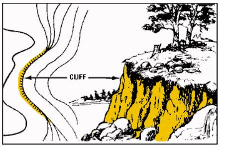 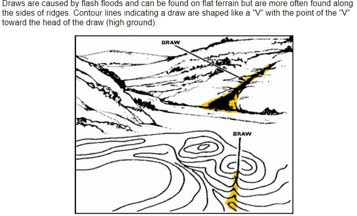 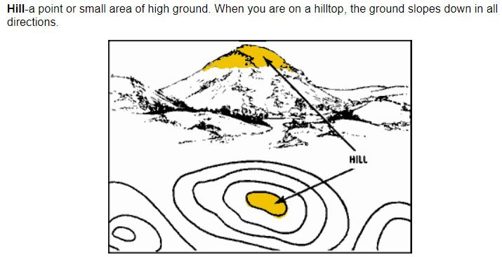 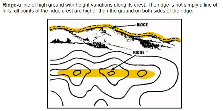 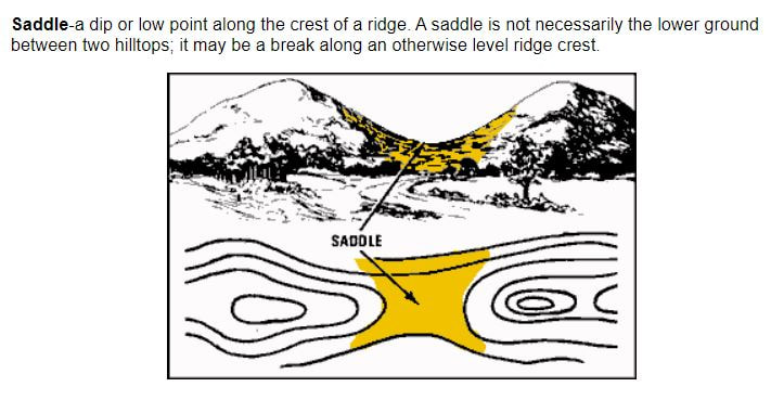 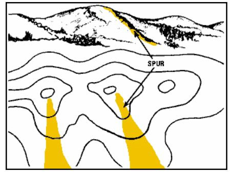 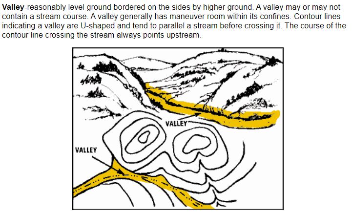 Obviously these are not all of the terrain features you will come across but these are most of the important ones. Remember, even if you are in an emergency the fastest way to get somewhere is not always in a straight line! It is vitally important to take out your map and utilize terrain to your advantage in an emergency situation!
As always I hope this post was useful and interesting to you guys! Thanks for reading and have a great week!
0 Comments
Leave a Reply. |
Special EventsRecord your WOD on Beyond the Whiteboard.
Do you need CrossFit or yoga gear? Click on the links below to buy through our GORUCK, Reebok, Rogue or Affiliate share sale programs. These are affiliate links and our gym will be compensated if you make a purchase after clicking on these links.

 Check out our Flickr page!
Categories
All
Archives
April 2024
|
True Spirit CrossFit
 RSS Feed
|

|